
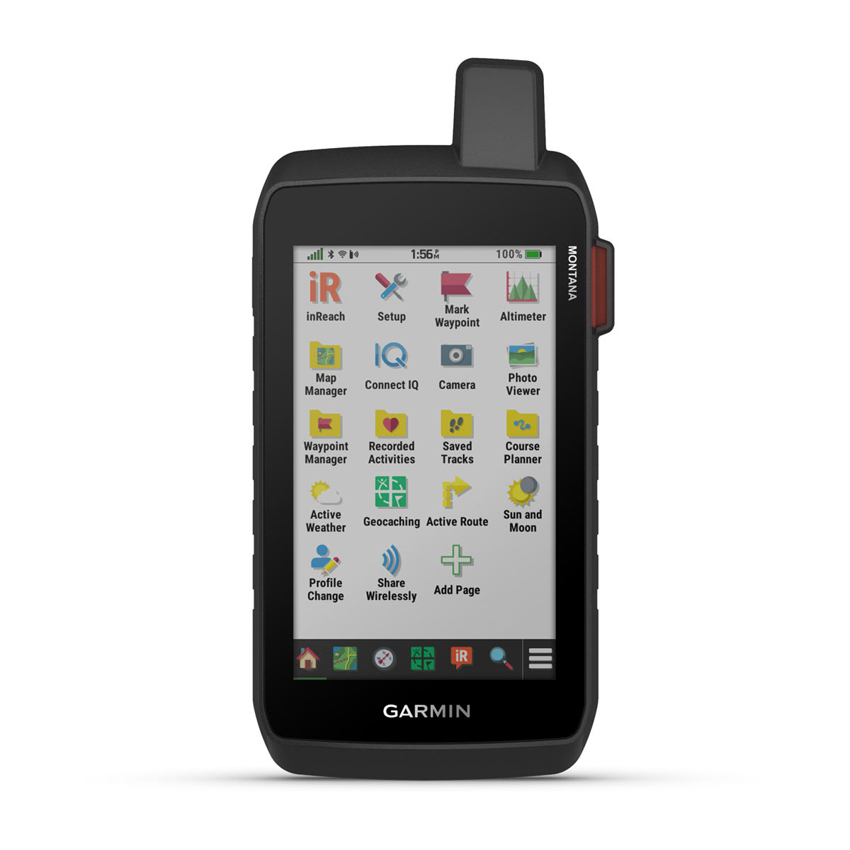
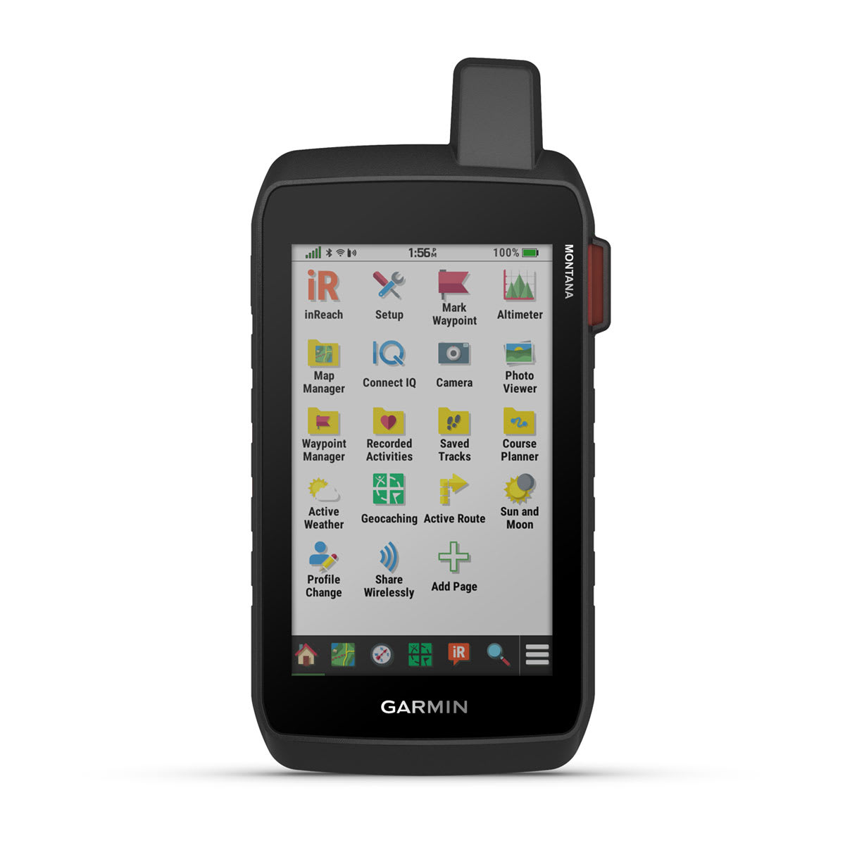

STAY ON TRACK AND IN TOUCH WHILE CAPTURING YOUR ADVENTURES
Get advanced outdoor features, inReach satellite technology for two-way messaging and interactive SOS alerts1 plus a built-in camera — all housed in a rugged 5-inch format that’s ideal for navigation on foot, bike, kayak, ATV and more.
WHAT YOU'LL LOVE
GLOBAL CONNECTIVITY
With an active inReach subscription, you can stay connected even when your adventures go off grid. Instead of relying on cellphone coverage, now your messages, SOS and tracking are transferred via the 100% global Iridium® satellite network1.
BUILT-IN CAMERA
Capture images of your adventures with this Montana 760i device, featuring an integrated 8-megapixel autofocus camera. It geotags photos with coordinates, so you can navigate back to favorite sites in the future.
RUGGED BY DESIGN
This durable, water-resistant handheld is tested to meet MIL-STD 810 for thermal, shock, water and vibration. It features a glove-friendly 5-inch touchscreen and is compatible with a variety of robust mounting solutions (sold separately) to best suit your activities.
TOPOACTIVE MAPS
To navigate your adventures, use preloaded worldwide topographical maps. View terrain contours, elevations, coastlines, rivers, landmarks and more.
SATELLITE VIEWS
Access subscription-free, high-resolution satellite imagery with direct-to-device downloads over Wi-Fi® connectivity. See photorealistic overhead views of routes and surrounding terrain, and easily create waypoints based on landmarks.
OUTDOOR MAPS+
Add a subscription to Outdoor Maps+ (sold separately), and get ongoing access to a wide variety of premium mapping content and regular updates sent right to your Garmin device via Wi-Fi technology.
EXPLORE THE WORLD. STAY CONNECTED TO HOME.
INREACH FEATURES
TWO-WAY MESSAGING
Exchange text messages with loved ones back home, or communicate via inReach device to inReach device in the field1.
INTERACTIVE SOS
In case of emergency, trigger an interactive SOS message to Garmin ResponseSM, a 24/7-staffed professional emergency response coordination center1.
INREACH WEATHER
Available inReach weather forecast service provides detailed updates directly to your Montana handheld or paired devices, so you’ll know what to expect en route1.
LIVETRACK™ FEATURE
Loved ones can follow your location in real time2 and see data such as distance, time and elevation.
NAVIGATION FEATURES
GARMIN EXPLORE™ APP
Pair with the Garmin Explore app to plan and review trip data, plus manage your waypoints, courses and activities.
MULTI-GNSS SUPPORT
Access to GPS and Galileo satellite networks enables Montana 760i to track in more challenging environments than GPS alone.
ABC SENSORS
Navigate your next trail with ABC sensors, including an altimeter for elevation data, barometer to monitor weather and 3-axis electronic compass.
CITY NAVIGATOR® MAPS
Seamlessly transition from trails to road navigation with preloaded City Navigator street mapping, which guides your drive with easy-to-follow turn-by-turn directions.
ADDITIONAL MAPS
With 32 GB of onboard memory, you can download even more maps, such as BlueChart® g3 charts for the water (sold separately).
ACTIVE WEATHER
Access up-to-date active weather forecasts via the Garmin Connect™ app on your compatible smartphone.
DOG TRACKING
For hunters and trainers, this Montana handheld syncs with your compatible Astro® or Alpha® series handhelds to help track sporting dogs in the field.
WIKILOC TRAILS
This preloaded app lets you easily download hiking, cycling and other Wikiloc trails shared by outdoor enthusiasts like you. Get a free 60-day Wikiloc Premium trial to try this and other exclusive features. Learn more.
ADVENTURE FEATURES
EXPEDITION MODE
Trek far and wide off-grid. Use expedition mode, an ultralow-powered GPS reference, to keep Montana tracking for more than 2 weeks between recharges.
BATTERY OPTIONS
A rechargeable lithium-ion battery pack provides up to 24 hours of battery life in GPS mode and charges with a standard USB-C® cable.
VEHICLE MOUNTS
A variety of Montana handheld-compatible mounts (sold separately) lets you adapt your navigator for use on ATVs, boats, cars, motorcycles, RVs or other vehicles.
In the Box
- Montana 760i
- High capacity lithium-ion battery pack
- USB cable
- Documentation
Specifications
| General | |
|---|---|
| Lens material | chemically strengthened glass |
| Dimension | 3.6" x 7.2" x 1.3" (9.19 x 18.30 x 3.27 cm) |
| Weight | 14.5 oz (410 g) with included lithium-ion battery pack |
| Water rating | IPX7 |
| MIL-STD-810 | yes (thermal, shock, water, vibe) |
| Touchscreen | Yes |
| Display Type | WVGA transflective, dual orientation |
| Display Size | 2.55"W x 4.25"H (6.48 x 10.80 cm); 5" diag (12.70 cm) |
| Display resolution | 480 x 800 pixels |
| Battery Type | rechargeable lithium-ion (included) |
| Battery life | GPS Mode: up to 24 hours GPS Mode with a text message or location sent every 10 minutes: up to 24 hours Expedition Mode: up to 440 hours Expedition Mode with a text message or location sent every 30 minutes: up to 400 hours Powered Off: up to 1 year Note – Battery life estimates are with full sky view and can be significantly impacted by obstructions or tree cover. |
| Memory/History | 32 GB (user space varies based on included mapping) |
| Interface | high-speed USB-C |
| Maps & Memory | |
| Preloaded maps | yes (TopoActive, by region; City Navigator, North America) |
| Ability to add maps | Yes |
| Basemap | Yes |
| Automatic routing (turn by turn routing on roads) for outdoor activities | Yes |
| Automatic routing (turn by turn routing on roads) for motorized vehicles | Yes |
| Map segments | 15,000 |
| Satellite imagery | yes (direct to device) |
| Includes detailed hydrographic features (coastlines, lake/river shorelines, wetlands and perennial and seasonal streams) | Yes |
| Includes searchable points of interests (parks, campgrounds, scenic lookouts and picnic sites) | Yes |
| Displays national, state and local parks, forests and wilderness areas | Yes |
| External memory storage | yes (32 GB max microSD™ card) |
| Waypoints/favorites/locations | 10,000 |
| Courses | 250, 200 course points per course |
| Tracks | 250 |
| Navigation Track Log | 20,000 points, 250 saved gpx tracks, 300 saved fit activities |
| Navigation Routes | 250, 250 points per route; 50 points auto routing |
| Rinex logging | Yes |
| Sensors | |
| GPS | Yes |
| Galileo | Yes |
| Barometric altimeter | Yes |
| Compass | Yes (tilt-compensated 3-axis) |
| High-sensitivity receiver | Yes |
| GPS compass (while moving) | Yes |
| Daily Smart Features | |
| Connect IQ™ (downloadable watch faces, data fields and apps) | Yes |
| Smart notifications on handheld | Yes |
| Weather forecasts | Yes |
| Weather | Yes |
| Compatible with Garmin Messenger app | Yes |
| VIRB® Remote | Yes |
| Pairs with Garmin Connect™ mobile | Yes |
| Safety and Tracking Features | |
| LiveTrack | Yes |
| Tactical Features | |
| Ballistics solver | Yes |
| XERO™ Locations | Yes |
| Outdoor Recreation | |
| Area calculation | Yes |
| Fish forecast | Yes |
| Sun and moon information | Yes |
| Geocaching-friendly | yes (Geocache Live) |
| Custom maps compatible | yes (500 custom map tiles) |
| Picture viewer | Yes |
| Camera | yes (8 megapixel; automatic geo-tagging) |
| LED beacon flashlight | Yes |
| Mapping & Navigation | |
| Point-to-point navigation | Yes |
| TracBack® | Yes |
| inReach® Features | |
| Interactive SOS | Yes |
| Weather | Yes |
| Send and receive text messages to SMS and email | Yes |
| Send and receive text messages to other inReach device | Yes |
| Send and receive group messages | Yes |
| Exchange locations with other inReach device | Yes |
| MapShare compatible with tracking | Yes |
| Virtual keyboard for custom messaging | Yes |
| Send waypoints to MapShare during trip | Yes |
| Send route selection to MapShare during trip | Yes |
| Outdoor Applications | |
| Compatible with Garmin Explore™ app | Yes |
| Garmin Explore website compatible | Yes |
| Smart switching between Wi-Fi, Cellular and Satellite with Garmin Messenger app | Yes |
| Dog tracking | yes (when paired to compatible dog track system) |
| Networking & Connections | |
| Wireless Connectivity | Wi-Fi®, BLUETOOTH® |
1. Active satellite subscription required. Some jurisdictions regulate or prohibit the use of satellite communication devices. It is the responsibility of the user to know and follow all applicable laws in the jurisdictions where the device is intended to be used.
2. When used with your compatible smartphone and the Garmin Messenger™ app or when used with your compatible inReach technology-enabled Garmin device
3. Wi-Fi is a registered trademark of the Wi-Fi Alliance. USB-C is a registered trademark of USB Implementers Forum. Satellite Imagery © 2026 Vantor (date of satellite imagery may vary).
Order processing times
Most orders will be processed in up to 72 hours. During seasonal times such as Black Friday, order processing time can take up to 5 business days. We appreciate your patience as we prepare your order.
Shipping times
Shipment dates & lead times will vary based on product availability, product may not be in stock. If you have a question regarding availability please email or call the office to discuss lead times. By completing payment, you have acknowledged the terms and conditions stated. As stock changes daily, we do not hold inventory, first come, first serve.
Currently some brands are experience major delays - contact us or more information.
Local pickup
We currently offer free pickup from our location. You will be notified via email or phone when your item(s) are ready for pickup.
Returns
We will accept returns within 30 days of original purchase and provide a store credit ONLY, no cash or credit card refunds will be given. All returns are subject to a 20% restocking fee. The product must still be in the original clean packaging, unused and uninstalled. We do not refund shipping and handling charges and the customer is responsible for all return shipping charges. There will be an additional rebox fee charged if the packaging needs to be replaced so please double box your returns. There is no returns of special order, tuners or custom parts.
Cancellations
Custom parts may not be canceled once your order is placed. Cancelled Orders may be subject to a 15% cancellation fee. All returns must be pre-authorized with a Battle Born Offroad Employee and have an RGA # or they will be returned to you. Refunds will be processed within 48hrs once product is received and in original condition. Most refunds are issued to the original payment method, or by check. Please allow up to 7 business days for store credit to reflect.
Website errors
In the event a product is listed at an incorrect price due to typographical, photographic, or technical error or error in pricing information received from our suppliers, Battle Born Offroad Ltd shall have the right to refuse or cancel any orders placed for product listed at the incorrect price.
Payment processing
By clicking checkout, you agree to have your payment ran anytime after checkout. Some orders may not be charged right away, and you authorize Battle Born Offroad to charge your card up to 365 days after completing your purchase for the maximum amount you paid.
SOME ORDERS DO NOT SHIP RIGHT AWAY
Most Orders will ship within 72hrs. Some parts may not in stock and may incur a 1-52 week time due to limited availability. If you want to check the most up to date lead times on any of these products please email us at info@BattleBornOffroad.net
How can I contact you if I have questions before ordering?
You can call us directly at 702-333-0868, email our support team, or message us on our chat or on social media. We’re here to help you with fitment, installation, and product questions before you commit to a purchase.
Do you price match other retailers?
Yes, we strive to offer the best prices in town. If you find a lower advertised price from an authorized dealer, let us know—we’ll do our best to match or beat it. Some exclusions may apply for clearance or special-order items.
What is your shipping policy and how long will my order take?
We offer free or discounted shipping on most orders over $99. Orders typically ship within 1-3 business days; once shipped, standard transit times depend on your location, but generally most transit time is 2-3 days. Expedited shipping is available at checkout, and offers delivery as quick as 24hrs. Tracking info will be provided once your package is in transit and will be sent electronically to your email.
Do you offer installation services or do you only sell parts?
Yes, Battle Born Offroad offers professional installation in our Las Vegas shop for ALL products we sell (suspension, lift kits, lighting, etc.). If you’re interested in installation, please hit our live chat button, give us a call at 702-333-0868 or email us to get a quote or get on the schedule. We can assist with shipping your vehicle to us if you are out of state and build trucks from around the country!
What warranty do your products come with?
All of our products come with a manufacturer’s warranty covering defects in materials and workmanship. Warranty durations vary by product and brand. Damage from misuse, improper installation, or off-trail abuse may not be covered. To initiate a claim or have questions, please reach out to us via email at info@battlebornoffroad.net and please submit photos, your order number and a brief description of the issue you are facing.
Do you offer financing or payment plans?
Yes, we partner with financing providers (Affirm, Shop Pay, SNAP Finance & Koalifi) so you can pay over time. Options like “buy now pay later” or longer-term payment plans may be available. Terms and interest will depend on your credit. Affirm and Shop Pay will be shown during checkout and must be clicked during this process. Other options are offered in store or on the phone, please feel free to call us at 702-333-0868 to discuss more.
How do you handle damages or defects in shipping?
Please inspect your package immediately upon arrival. If you notice any shipping damage, take clear photos of the damage and packaging and email us within 24 hours of delivery. We will work to make it right, either replacement of the part, or arranging return/reimbursement as needed.
Still have a question?
See all our Frequently Asked Questions or contact us with questions.


User Name 2 Days ago
Lorem ipsum dolor sit amet, consectetuer adipiscing elit. Aenean commodo ligula eget dolor.